Port Metro Vancouver is inviting some public feedback on the draft land use plan it will use to guide the body through the next 15 to 20 years.
But don't expect any big surprises or drastic changes in the plan's outlook for the North Shore port properties.
"Frankly, there's not a lot of excitement in it because we're not going 'Aha! This whole area is changing its future and its destiny.' It's more about clarity, consistency and other things," said Greg Yeomans, the port's manager of planning. "There are no new terminals. There are no brand new industrial sites. Essentially the terminals are there and we're expecting them to stay there. The industrial development that's there, we're expecting to stay there for the foreseeable future."
Unlike a city's official community plan or zoning bylaw, the port's land use plan only uses eight broad definitions to describe a property's general use. The controversial upgrade of the Neptune coal terminal and the expansion of Richardson's grain terminal that were announced following approval of the Low Level Road project wouldn't have required any amendments to the old plan as they didn't change the use of the land or water.
Most of the changes laid out in the draft released this week involve taking land or foreshore that is currently undeveloped and designating it for conservation. Those spots include the foreshore at the northwest and northeast end of the Lions Gate Bridge, the Lynn Creek outflow, where the Seymour River meets the Burrard Inlet and the Maplewood Conservation Area and the inlet on its western edge.
"It's not creating vast new tracks of conservation lands. What it is is finding out there are number of smaller sites on the North Shore that are either cheek-by-jowl to a creek, or important habitat. They really have no development potential but they might have conservation or recreational value," Yeomans said.
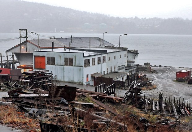
Similarly, the port is looking to formalize the area off Cates Park as recreational and the water in front of McKenzie Barge and Lynnwood Marina as commercial.
The one exception is a plot of land on Dollarton Highway just north of the Maplewood Conservation Area and east of Goldenwood Hall
boarding school. That area has been named a special study area, meaning the port is holding off on giving it a designation anticipating some future unknown use.
"The jury's out ultimately on what should happen on that site. We don't have a development proposal today. We don't have a specific development intent for the site. It's got pros and cons one way or another," Yeomans said.
It's likely a proposal will come forward in the next five years, he added.
Residents interested in commenting on draft plan or questioning port staff on land use can either attend one of a series of meetings set up by the port, or use an online tool launched this week.
The North Shore meeting takes place on March 6 at the Pinnacle at the Pier hotel, starting at 6:30 p.m. Beyond that, the port has set up an interactive map at porttalk. ca/landuseplan that details the proposed changes, and offers a chance to raise questions and comments that will go into The Creation Of The Final Plan.
In the end, it will be up to Port Metro Vancouver's board to adopt the plan, which Yeomans expects will happen at the end of 2014.


