This column is dedicated to celebrating outdoor recreation in the Seymour area. This month we learn how to explore majestic Mount Elsay in Mount Seymour Provincial Park, in this excerpt from 105 Hikes In and Around Southwestern British Columbia.
Beckoning with its panoramic views, Mount Elsay is the next major peak north of Mount Seymour in the Fannin Range. Rising in the territories of the Musqueam, Squamish, and Tsleil-Waututh First Nations, the mountain chain constitutes the divide between the Seymour River and the Indian River and Indian Arm.
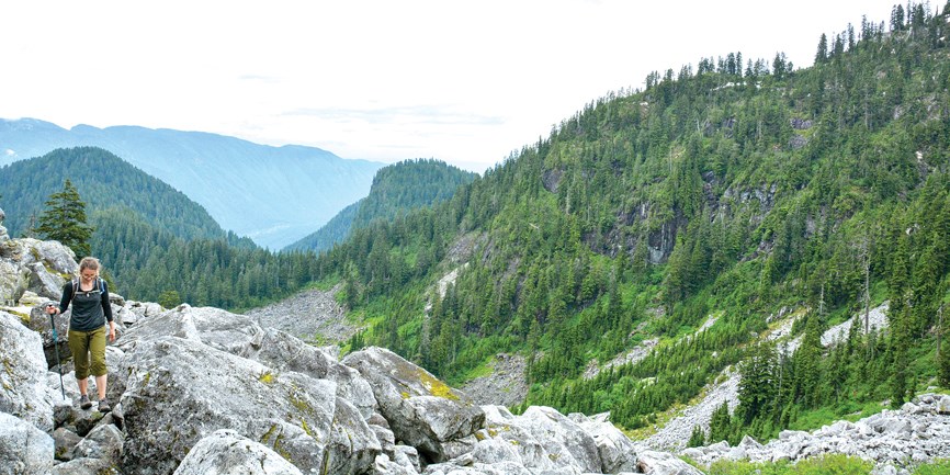
From the BC Parks kiosk at the top of Parking Lot 4, follow the Mount Seymour trail north for 2.2 kilometres to the junction east of Pump Peak. Embarking on a strenuous counterclockwise loop, head right on the Elsay Lake Trail; leave the music-blasting crowd behind and enter the wild backcountry of Mount Seymour Provincial Park.
With Runner Peak and your objective entering the view, plunge down Wes’s Staircase, next to a rockslide. Cairns with orange flagging lead north across talus and the headwaters of Coldwell Creek. Salmonberries and blueberries are plentiful in season. Enjoy the descent; it’ll be over soon.
Watch out for a junction in the woods, on the divide between Coldwell and Elsay creeks, 4.75 km from the parking lot. A large orange blaze on the left marks the start of the fun ascent. With some flagging, the Mount Elsay route climbs steeply under the trees to emerge in a bowl with a peaceful tarn. Cross a clear creek that feeds it, and clamber up a boulder field all the way to the Elsay-Runner col.
Turn right and head up the rooty forest path, easy slabs, and lingering snow to the summit cairn. Your 360-degree prize: Mount Bishop due north and Elsay Lake far below, Buntzen Lake across Indian Arm, Metro Vancouver and the Fraser Valley, Mount Seymour behind Runner Peak, the Gulf Islands, The Needles, etc.
Back at the col, go right to return via the rugged, slippery, and wickedly steep Mount Elsay Trail. Follow the west side of the ridge, cross boulder gullies, and drop to bypass Runner Peak. Finally, after 9 km of hiking, you rise to the Mount Seymour-Tim Jones Peak col. Turn right on the Mount Seymour Trail and head south over easier terrain to the trailhead. BC Parks discourages bringing dogs to the backcountry.
Distance: 13 kilometres. Time: 10 hours. Elevation gain: 500 metres. High point: 1,422 metres.
Stephen Hui is the author of 105 Hikes In and Around Southwestern British Columbia, a new guide from Greystone Books. 105hikes.com. ■


