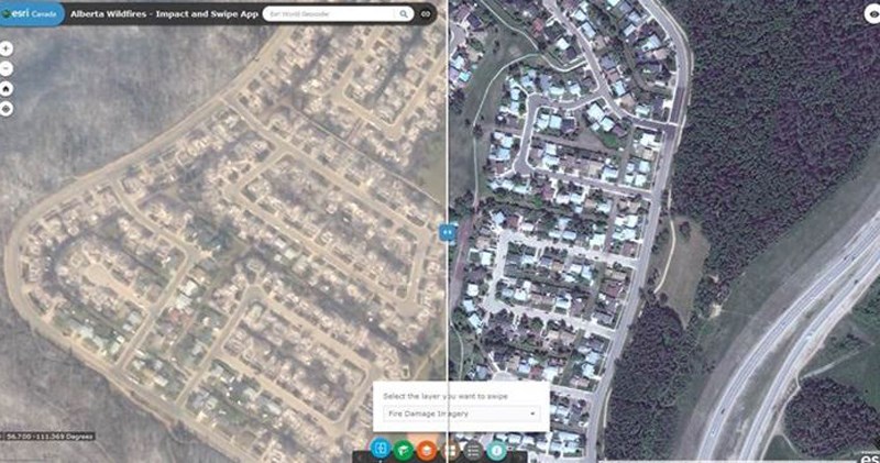
Esri Canada has released this Alberta Wildfires Swipe Map that uses satellite imagery taken before and after the recent wildfire that swept through Fort McMurray, Alberta, in May.
The map shows the path and extent of the devastation it has caused.
Through the haze from fires that continue to burn near the city, your readers will be able to see the outline of neighbourhood streets and building foundations where family homes once stood. They can also explore the widgets below the map to navigate to the various neighbourhoods of Fort McMurray and view additional layers of information including the latest active fires.
This swipe map follows the Fort McMurray Wildfires Public Information App that Esri Canada released two weeks ago.


