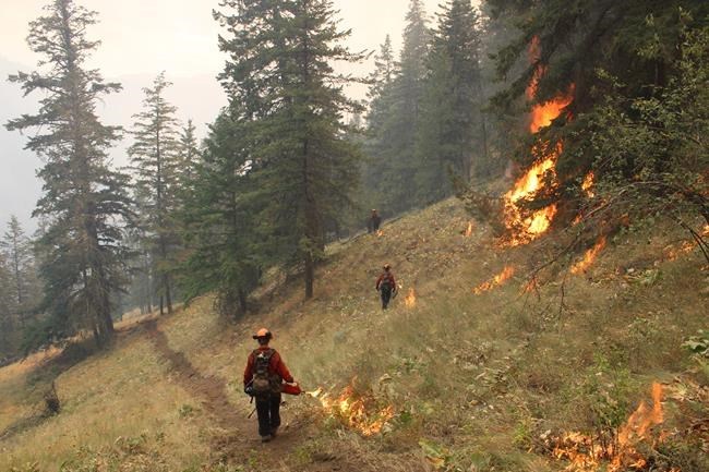
KEREMEOS, B.C. — Shifting wind patterns are keeping communities on edge in British Columbia's southern Okanagan, where an out-of-control wildfire forced the evacuation of the village of Olalla and residents of nearby Keremeos were told to prepare to leave.
Winds in the area are known for their unpredictability, which has firefighters and emergency officials preparing for the worst, Tim Roberts, the area's elected regional director, said Friday.
"We are always under the risk of Mother Nature, so it's always good to be preventive, prepared for the worst and hope for the best," he said in an interview.
He said the Indigenous name for Keremeos was "valley of the three winds, so you can tell, winds change hourly."
But after northerly and southerly gusts of 50 km/h late Thursday, conditions turned favourable Friday and winds subsided, allowing firefighters to try to halt the advance of the wildfire approaching Olalla.
"So far, it hasn't been as challenging a day, which is obviously fantastic," said BC Wildfire Service spokesman Bryan Zandberg.
He said firefighters worked to build protection areas outside Olalla, located about 40 kilometres southeast of Penticton.
"Again, we're focusing on Olalla and structural protection,' Zandberg said.
He said about 400 firefighters were battling the 51-square-kilometre Keremeos Creek blaze that forced Olalla's complete evacuation.
The Regional District of Okanagan-Similkameen said almost 550 homes were on evacuation order as of Friday afternoon due to the unpredictable nature of the fire.
More than 1,000 other properties are on evacuation alert, including those in the nearby village of Keremeos.
Much of the wildfire was concentrated in steep, mountainous terrain on Friday, and was less threatening to Olalla's estimated 400 properties, but that could change, Roberts said.
"It's a very unpredictable fire in regard to winds and terrain," he said. "You're looking at very steep inclines, bluffs, heavy timber clustered up in the mountainside."
The evacuation orders and alerts were issued late Thursday by the Regional District of Okanagan-Similkameen as winds caused the wildfire to flare in a "problematic corner," Zandberg said.
"What we were experiencing was quite challenging. Things did get pretty hairy along the 3A," Zandberg said during a briefing on Friday.
Winds have been pushing flames downhill toward the communities, forcing the closure of Highway 3A, which passes through Olalla and Keremeos.
The fire is one of 146 that the BC Wildfire Service reported over the past week, although new fire starts have dipped in the last two days due to slightly cooler, calmer conditions.
Environment Canada is forecasting a return to temperatures in the 30s this week, with gusty winds that could complicate firefighting efforts, but there's no sign of the lightning storms that have kindled many recent wildfires.
The BC Wildfire Service said this week that the province is expected to experience sustained wildfire activity in August and September, especially in southern regions, with a long-range forecast of hot, dry weather.
The wildfire service said six blazes are currently ranked as wildfires of note, but overnight rain helped crews contain two of them.
Wildfire service spokeswoman Roslyn Johnson said 10 millimetres of rain drenched the three-square-kilometre fire burning in grassland just north of Kamloops, reducing it to a smoulder.
The roughly 10-square-kilometre fire not far outside Pavilion near Lillooet also received about 16 millimetres of rain Thursday, which the wildfire service said would tamp down flames until at least Tuesday.
Other fires of note include a 37-square-kilometre blaze west of Lytton, where the wildfire service said cooler weather has "diminished" its activity.
The wildfire service said late Friday that the Weasel Creek wildfire, which was discovered July 30 northeast of Eureka, Mont., has crossed the border into Canada.
It said the Canadian portion of the blaze covered about 6.2 square kilometres in the Flathead Valley west of Frozen Lake.
Another fire in the Southeast Fire Centre grew after creeping into inaccessible terrain south of Cranbrook, but the other, south of Kaslo, has seen little change in the last day.
— By Dirk Meissner in Victoria
This report by The Canadian Press was first published Aug. 5, 2022.
The Canadian Press


