Metro Vancouverites should brace for a long stretch of wet weather as a series of storms impacts the B.C. coast over the next week.
On Wednesday (Jan. 12), Environment Canada issued a rainfall warning for Metro Vancouver, calling for 60 to 120 mm to fall by Friday. While the special weather statement has ended, the weekly forecast looks wet, with showers or rainfall expected every day over the next week.
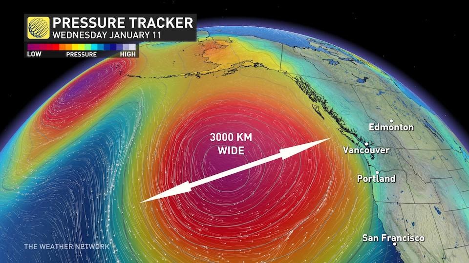
A "strong low" is responsible for a series of storms that will continue to drench the Lower Mainland through the weekend and into next week, according to The Weather Network.
Churning in the eastern Pacific Ocean at over 3,000 km wide, the strong low is "on the upper end of what the atmosphere is capable of generating," notes the forecaster.
Since it is expected to shrink down to about 1,000 km in the next few days, the low-pressure system will not meet the criterion for an atmospheric river -- but the duration of the wet weather is "concerning."
Some cities will "face up to 60 hours of rainfall that will taper to showers on Saturday," while temperatures are expected to drop heading into next week. The Lower Mainland will continue to see rain but ski hills will likely see heavy snowfall.
When will the rain ease up? The Weather Network calls for a reprieve from Metro Vancouver's wet weather in the final week of the month.


