Hiking season is almost upon us in B.C.
With thousands of picturesque trails scattered across the province and higher-than-usual temperatures this May, plenty of hikers are no doubt itching to lace up their boots, pack their bags and head out into the wilderness in the coming months. Whether due to injury, illness or simply taking a wrong turn, some of those hikers will inevitably need help getting out of the remote terrain they ventured into—that's where the province's search-and-rescue (SAR) volunteers come in.
But those 78 ground search-and-rescue groups and their more than 3,400 highly-trained volunteers respond to more calls for help on some trails than others. Ahead of the May long weekend, the BC Search and Rescue Association (BCSARA) released a list of the 10 B.C. trails where rescuers responded to the highest number of hiking-related incidents in 2022.
About half of those routes are in the Sea to Sky corridor—three in Whistler, two in Squamish—while three trailheads are located on Vancouver’s North Shore, and two more are on Vancouver Island. A total of 98 hiking-related incidents necessitated a SAR response on these 10 trails, representing about one in every five hiking-related incidents that occurred across B.C. in 2022.
In ascending order of highest call volume, they are:
10. Cape Scott Trail
The 23.6-kilometre trail in the rugged, coastal provincial park near Port Hardy, at the northwestern tip of Vancouver Island, takes hikers an average of 8.5 hours to complete one way. The original trail is also the gateway to the 43.1-km North Coast Trail, a multi-night wilderness route that backpackers usually take between five and eight days to complete.
SAR crews were called to the Cape Scott Trail on five occasions in 2022.
9. Rainbow Mountain Trail
Whistler’s Rainbow Mountain Trail saw six hiking-related incidents requiring SAR assistance last year.
The trailhead might be a short jaunt from any one of the homes in Whistler’s Alpine Meadows neighbourhood, but its 24.3-km distance and 1,731-m of elevation gain brings hikers into remote alpine terrain on the west side of the Whistler Valley.
8. Mount Seymour Trail
The 7.9-km, 555-m elevation trail in Mount Seymour Provincial Park might be rated as slightly less challenging compared to some other routes on this list, but its proximity to Vancouver means this trail sees high traffic in the summer months. Seven hikers called SAR crews for help on the trail in 2022.
7. Wedgemount Lake Trail
Known as one of the steeper hikes in Whistler, Wedgemount Lake’s reputation as a gruelling trek doesn’t do much to dissuade hikers from heading uphill to take in the icy blue Wedgemount Lake (and the rapidly receding glacier) at the top. The 12-km, 1,160-m elevation out-and-back in Garibaldi Provincial Park was the site of eight hiking-related SAR incidents in 2022.
6. Grouse Grind
Referred to as “Nature’s Stairmaster” by some, the Grouse Grind is a highly popular, 2.5-km uphill-only route within North Vancouver city limits. SAR volunteers were called to help nine hikers on the Grind last year.
5. Sea to Summit Trail
This route winds its way uphill through Squamish’s coastal rainforest, directly underneath the Sea to Sky Gondola. Like the Grouse Grind, that means hikers have the option to download from the summit via a gondola cabin rather than subject their knees to a brutal descent. Still, the trail's 918 m of elevation gain over 7.5 km doesn’t make for an easy climb. Ten SAR incidents took place on the trail in 2022.
4. Stawamus Chief Trail
Directly beside the Sea to Summit route is one of the most popular hikes in the province, offering similarly panoramic views of the Howe Sound in exchange for a similarly steep trek. Once at the top of the Stawamus Chief massif, hikers can choose to bang out one, two or all three peaks, but a quick rip up to the 600-m first peak and back to the car park usually takes about two hours (depending on each hiker’s fitness level, of course). Squamish SAR crews responded to 11 separate hiking incidents on the Chief last year.
3. Juan de Fuca Marine Trail
The second Vancouver Island trail on the list is located in Juan de Fuca Provincial Park, on the southwest coast of the island about 80 km from Victoria. Hikers can choose to begin their multi-day hike at one of four trailheads along the 47-km route, though the area is just as popular for single-day visits. Thirteen incidents along the trail necessitated a SAR response in 2022.
2. Howe Sound Crest Trail
Tied with Juan de Fuca Marine Trail for the second-highest call volume is the Howe Sound Crest Trail (HSCT), which also recorded 13 hiking-related SAR calls last year. The approximately 29-km point-to-point trail beginning in Cypress Provincial Park is just as popular among trail runners as it is with overnight hikers, despite its 2,502-m elevation gain traversing over several coastal summits. Some hikers choose to instead tackle a portion of the trail, for example the 5.5-km trek to St. Mark’s Summit. One end of the HSCT trail is situated on West Vancouver’s Cypress Mountain, while the other end pops out near Porteau Cove on the Sea to Sky Highway, north of Lions Bay.
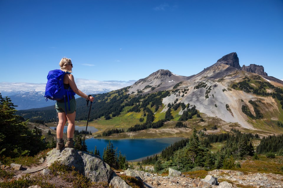
1. Rubble Creek Trail
Out of all the hiking trails in B.C. (more than 7,500, according to AllTrails), the Rubble Creek Trail in Whistler saw the most traffic from SAR crews last year. It’s a popular access point for many of the most stunning objectives accessible by foot in Garibaldi Provincial Park, like Garibaldi Lake, Black Tusk and Panorama Ridge. The Rubble Creek trailhead is located 28 km south of Whistler Village, and a little over 36 km north of Squamish.
B.C. SAR volunteers visited the trail on 16 different occasions in 2022.
Why are all of these trails in southwest B.C.?
It’s no surprise so many of those trails are located along B.C.’s South Coast. The region is B.C.’s most heavily populated, with 2.7 million residents, or 61 per cent of B.C.’s total population as of 2018.
Trail usage has also spiked considerably since the COVID-19 pandemic began a little over three years ago. A 2020 study conducted by Rec Sites & Trails BC monitored visitor use on 21 hiking trails in the Sea to Sky Natural Resource District, and found usage on some of those local trails rose by more than 100 per cent year-over-year.
According to the province, visits to BC Parks on the South Coast skyrocketed to 10.3 million in 2019, up from 6.5 million in 2010.
In response to those increasing visitor numbers, B.C.’s Ministry of Environment implemented a free day-use pass program in 2020 for some of its busiest backcountry destinations during high season. This summer, hikers need an individual pass to visit Joffre Lakes Provincial Park near Pemberton, or vehicle passes for Golden Ears Provincial Park and several trailhead parking lots in Garibaldi Provincial Park, including Diamond Head, Rubble Creek and Cheakamus.
People can reserve a day-use pass at no cost through BC Parks’ reservation site, beginning two days before their arrival at 7 a.m.
What causes most of B.C.’s hiking-related incidents?
In Thursday’s news release, BCSARA also shared the top three reasons why hikers across the province found themselves requiring SAR services last year. Out of the nearly 500 hiking calls SAR volunteers received in 2022, the most common emergency hikers experienced was getting lost without a map or navigation device. SAR volunteers responded to 107 calls from hikers in that situation.
The second most common emergency was poor footwear and/or footing leading to a slip or fall (94 calls) followed by hikers who exceeded their ability or were unaware of the trail’s difficulty rating (70 calls).
All three of those hiking emergencies are, for the most part, preventable with proper planning. To avoid the kind of incidents that require rescue, BCSARA encourages hikers to wear appropriate footwear, pack a navigation tool like a digital and/or paper map (and make sure you know how to use it), research the trail’s difficulty and conditions, and finally, use sound judgment and turn around if you find yourself getting tired or in over your head.
To help hikers prepare for their trip, BCSARA created safety-specific trail videos to give users an idea of the conditions they may encounter on six of those top-10 trails. That project was completed with the support of partners like Emergency Management and Climate Readiness, Metro Vancouver, Royal Canadian Mounted Police (RCMP), Avalanche Canada, BC Parks and regional SAR groups, BCSARA added in the release.
Find those videos here, or register for BC AdventureSmart’s summer safety webinar series. Beginning May 18 and running until August 3, the webinars have enlisted a slate of special guests and industry experts to help inform backcountry users about personal preparedness and smart outdoor practices.


