Residents living near the City of North Vancouver’s brand new Mosquito Creek Bridge are worried the newest piece of city infrastructure isn’t designed for the rushing waters underneath.
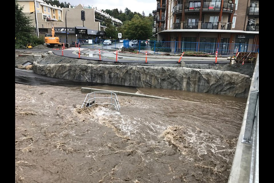
Like most bodies of water, Mosquito Creek is subject to flooding in times of heavy rain, but the walkway under the new bridge disappears under fast rushing water.
According to Environment Canada, almost 150 millimetres of rain fell on the North Shore before last weekend’s atmospheric river. But even before the heaviest rains arrived, area residents saw worrying signs, said Jennifer Vaughan, who lives nearby on 14th Street.
“It floods up to just underneath the bridge. It's up that high. It's crazy," she said.
The trail is already popular with neighbourhood kids walking to school, Vaughan said, and people living homeless tend to seek out the bridge for shelter.
“What if they get caught underneath the water,” she said. “It seems still dangerous that the river runs through there and at times could catch somebody off guard.”
Vaughan said she understands fisheries regulations don’t allow the installation of lighting that points down on the water, so residents were already leery about passing through after dark, Vaughan added.
Also troubling for the neighbours is their storm drain exiting into the creek below the high-water mark. When the creek swells and debris blocks the culvert, there is a greater risk of flooding, not just of the street above the creek but of their underground parkade, Vaughan said.
Much of the South Coast was under a high stream-flow advisory leading into the worst of the weekend’s weather. On Friday afternoon, The BC River Forecast Centre upgraded the advisory to a flood watch for the Metro Vancouver, the North Shore and Sunshine Coast, meaning river levels could approach or exceed their banks, with flooding of adjacent areas possible. Those warnings are no longer in effect.
In response, the City of North Vancouver released a statement Monday, saying the city considered the replacement of the previous bridge an opportunity to extend the trail system down to the Spirit Trail without having to change the elevation of Marine Drive.
“In order to provide enough clearance under the new bridge, the multi-use path and surrounding infrastructure was intentionally designed and engineered to accommodate temporary flooding during periods of intense rainfall events and high stream flows in the creek,” the statement read. “During the fall and winter, the city will be monitoring the creek and implementing closures or performing upgrades as required to ensure no danger or risk to the public or surrounding areas. Appropriate signage with detour information will be posted.”
A planned extension of the underpass curb to the north is expected to reduce the frequency of flooding, the statement continued, and city staff expect it to be fully open by the end of the month.

