It's snow time!
While you won't likely spot any white stuff down around sea level, the Vancouver weather forecast calls for snow over "higher terrain" tonight.
In its daily update for the city, Environment Canada calls for a foggy start to Tuesday, Dec. 29, followed by rain in the evening. Places around sea level are expected to see around 20 mm of rainfall, while higher elevations could see up to 4 cm of snowfall. The overnight low is expected to dip down to 3°C, but it is also expected to be windy near the water.
Following Tuesday's snow event, Wednesday morning looks decidedly blustery, with the forecast calling for the possibility of more snow over high terrain, and 20 to 30 mm of rainfall at sea level with winds up to 20 km/h. However, places along the water are expected to see winds up to 60 km/h.
Wednesday night is expected to be slightly milder than Tuesday night, with temperatures dipping down to 5°C. As such, no snow is expected Wednesday night or into Thursday morning. Instead, Thursday is expected to see a high of 7°C during the day with temperatures remaining steady into the night. Similarly, Friday's forecast calls for more rain and a high of 8°C.
The weekend is also looking wet, and the beginning of next week is calling for rain.
Metro Vancouver Weather Forecast
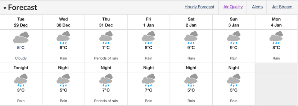 By Environment Canada
La Niña Winter
The Canadian Government defines La Niña as "the appearance of cooler than normal waters in the eastern and central Pacific Ocean"—A.K.A. the waters off B.C.'s coast. Sometimes also referred to as "a cold event", the climate pattern is generally considered to be the opposite of El Niño, and is usually great news for skiers and snowboarders hoping for a season full of champagne powder.
"This year we have entered into a linear pattern and it's almost 100% going to stick around for December, January, and February--and beyond. It's a moderate to strong La Niña and with that, what we call a teleconnection is when it's going to actually impact us here in B.C.," says Castellan.
While La Niña was identified back in August, it didn't have a significant bearing on local weather at that time. But mid to late December onward, B.C. will likely see colder than normal temperatures, with a much higher level of certainty than Environment Canada will normally give for seasonal projections, Castellan explains. After that, the pattern is expected to continue into spring.
Read more here.
--With a file from Megan Lalonde.


