The record hot, dry weather dominating B.C.’s South Coast is not expected to go away anytime soon, according to Environment Canada.
Drought conditions and unseasonably warm temperatures broke a number of records across the province in September.
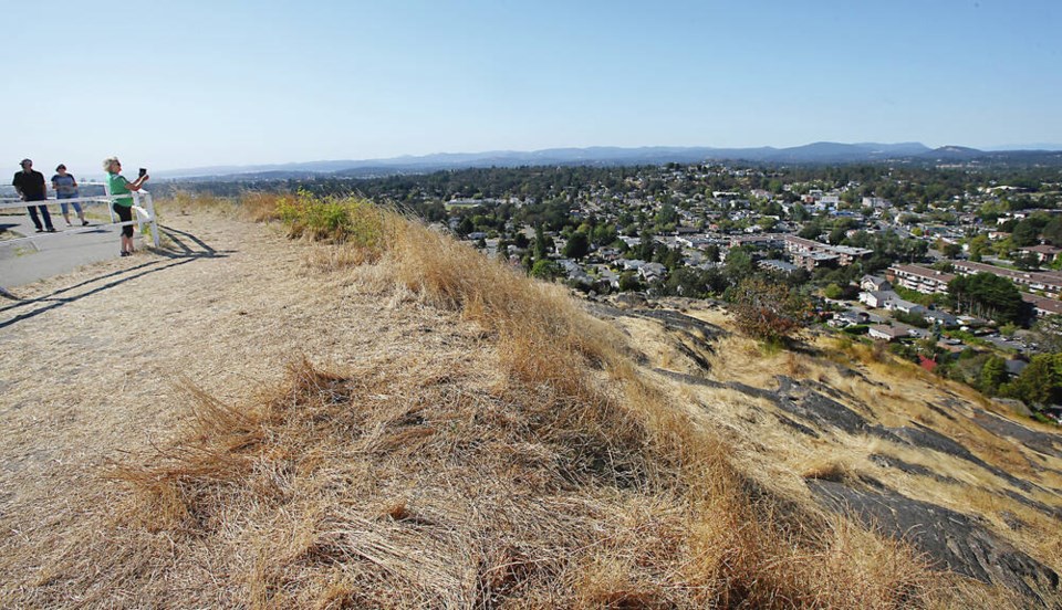
In the province’s capital, Victoria International Airport reported last month was the second driest and the hottest September on record.
“The temperature and rainfall we had for the month of September were extreme for Vancouver Island, and that hasn’t changed for the first week and a half of October,” said Environment Canada meteorologist Alyssa Charbonneau.
She said the province’s Lower Mainland has faced similar “much-warmer-than-normal” conditions. While Vancouver International Airport reported the fourth warmest on record, Abbotsford had the warmest and driest September on record going back to 1945.
“The rivers are low. We're seeing drought levels increasing at this time of year which we normally would not have,” Charbonneau told Glacier Media. “We're kind of just in a prolonged summer.”
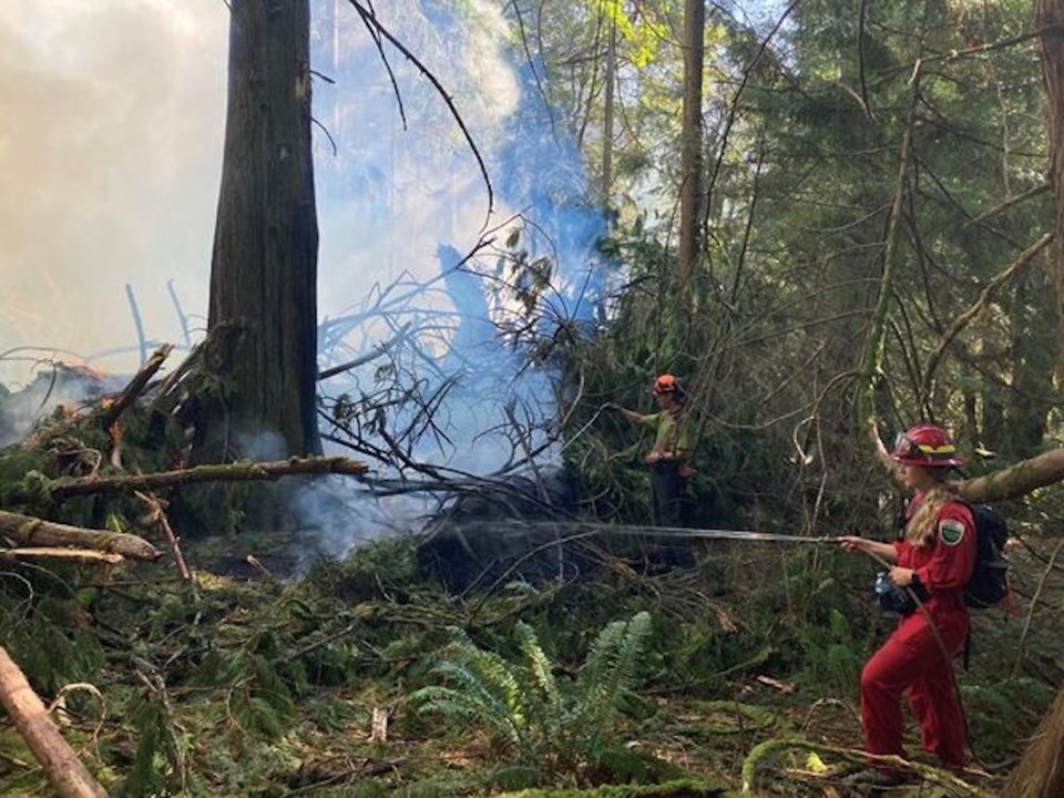
“The drought conditions are getting worse. And we're also seeing wildfire risk continuing.”
The number of active wildfires in the province had climbed to 205 as of Wednesday, a spike of 17 new fires in the past two days, according to the BC Wildfire Service.
As of Oct. 11, high to extreme wildfire danger ratings covered nearly all of the South Coast and Vancouver Island, something Charbonneau says is “quite unusual.”
The only future certainty is uncertainty
Scientists who have modelled the effects of human-caused climate change in British Columbia say the region can expect more drought in the summer months and more extreme rainfall at other times.
But that’s an average, and Charbonneau says individual years will bring their own unpredictable collection of weather events, not all of them driven by climate change.
“We are susceptible to extreme weather events here,” she said. “There are no guarantees that what we see this year will be what we see next year.”
That's likely little comfort to communities on the Sunshine Coast, struggling to provide an emergency supply of water to its residents; or to the Heiltsuk First Nation, whose members last week found thousands of dead wild salmon in a creek bed left stranded when the water dried up.
Little change in the near-term
At this time of year, B.C.’s coast normally is dominated by fall storms.
What’s different this time around is a stubborn high-pressure system that has crept up from the south and established itself over the province.
“It's not going anywhere, at least for the next week or so,” said Charbonneau of the ridge of high pressure. “That means that all the weather systems that are coming are being deflected to the north, into the Gulf of Alaska, impacting the Alaska panhandle and Yukon.”
Over the next two weeks, she says temperatures are expected to reach into the high teens and low 20s, five degrees Celsius above average for this time of year.
Only then do weather models start to show a signal that there may be a break in the hot, dry weather.
“In terms of how much rain those storms might bring, it’s so far away it’s really hard to know,” said the Environment Canada meteorologist.
B.C. coastal winter still could be cold, wet
The U.S. National Weather Service’s last seasonal outlook for the Pacific Northwest — a region that borders B.C.'s South Coast — predicted above-average precipitation through October, November and December.
Charbonneau says even if dry, hot conditions persist for the next couple of weeks on B.C.’s South Coast and Vancouver Island, that could quickly shift to a La Niña-dominated winter in late fall.
La Niña and El Niño are used to describe warm and cool phases of a climate pattern that shifts across the tropical Pacific every three to seven years. As sea surface temperatures swing back and forth between Australia and South America, they cause knock-on effects that disrupt temperature and precipitation patterns thousands of kilometres away — often in somewhat predictable ways.
In B.C., a cycle dominated by an El Niño pattern tends to lead to warmer winters, whereas a La Niña winter tends to be cooler.
According to the U.S. Climate Prediction Center’s last update on the status of the El Niño/Southern Oscillation, La Niña conditions are expected to persist for a third straight winter in the Northern Hemisphere. The Climate Prediction Center is expected to provide another update on Oct. 13.
Without any clear signal of things changing in B.C. in the near-term, Charbonneau says the long-term pattern remains “so uncertain.”
“For example, last winter, we really didn’t see that kind of characteristic La Niña until late,” she said. “It doesn’t give us much to hang our hats on.”
As for the potential for a cooler winter — something the Farmers' Almanac predicted could lead to “decent” ski season this year — Charbonneau says it’s still not out of the question.
“We could still see lots of precipitation through the month of November, December,” she said.
“There's nothing to say that it won't happen.”


