Spring has sprung — according to meteorologists — but you wouldn't know it by stepping outside.
Metro Vancouverites were met with a dusting of snowfall on Sunday, March 3 and temperatures are expected to feel as cold as - 9 C with the wind chill overnight Monday. Snow flurries are also possible again overnight on Tuesday.
But the lion's share of the spring season isn't expected to feel as wintry as it started (and the month is famous for starting with a stormy roar, anyway).
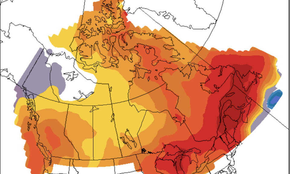
Environment Canada meteorologist Derek Lee says the national weather forecaster is calling for a warmer-than-average spring, thanks in part to a strong El Niño influence.
While El Niño tends to produce warmer winters in Metro Vancouver, other factors, such as a blast of arctic air, can change the monthly average. For example, January's mid-month, record-breaking cold snap married with its record-breaking daytime highs at the end of the month produced a near-typical average for the month overall. Before this, however, December was one of the mildest on record in numerous cities provincewide.
El Niño's impact is expected to persist through March and switch to "neutral" in April. But since this year's El Niño is considered "strong," it could continue to influence local weather for a longer period.
Long-term Metro Vancouver weather forecast includes transition to La Niña
After it transitions to an ENSO-neutral phase, most global weather models indicate that it will develop into a La Niña pattern by June through August, according to the International Research Institute for Climate and Society.
Environment Canada expects April and May to experience warmer-than-normal temperatures, with about 50 to 60 per cent confidence. Before this, March is expected to see near-normal temperatures but this could be due to its frosty start, Lee explained.
There is no confident signal for precipitation this spring but there was a significant dumping of snowfall on local mountains over the past couple of weeks. This has been a boon for the province's depleted snowpack, which was 61 per cent of its normal amount at the start of February.
"It was looking bleak for the melt season but now that we have more snow it is different," Lee said.
The B.C. River Forecast Centre will release an update on the current snow conditions and water supply on March 8.
Stay up-to-date with hyperlocal forecasts across 50 neighbourhoods in the Lower Mainland with Weatherhood.


