The Metro Vancouver weather forecast includes a parade of storms to kick off the week — but the heavy rain is expected to ease up mid-week.
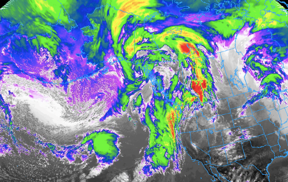
Environment Canada was expecting one of the strongest atmospheric rivers to drench the Lower Mainland with substantial rainfall. While it received significant precipitation over the weekend, Vancouver Island and the local mountains received the majority of the wet weather.
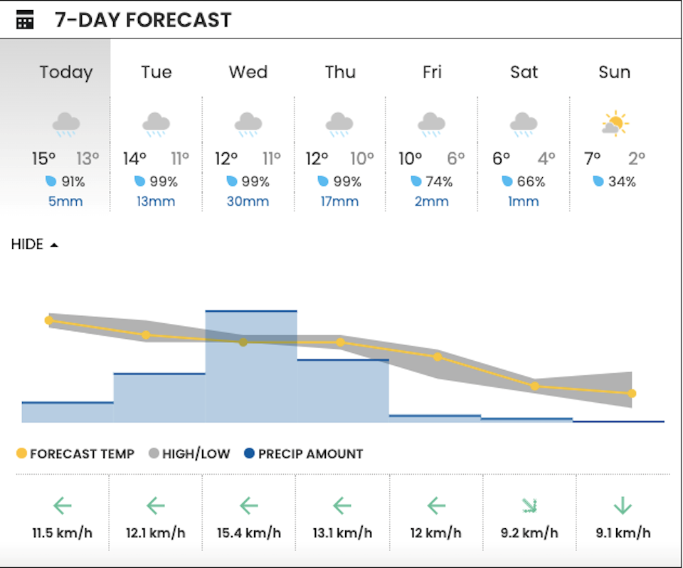
Monday morning saw a brief reprieve from the rain and some significantly milder temperatures. V.I.A.'s Downtown Centre Weatherhood station shows a high of 15 C and a low of 13 C, with similar temperatures expected on Tuesday (a high of 14 C and a low of 12 C).
The average daytime high for Metro Vancouver is just shy of 7 C and the low is 0.7 C, according to the department's historical climate data.
Environment Canada meteorologist Lisa Erven told V.I.A. that a potent system moving from the south will continue to bring atmospheric rivers to the south coast over the next couple of days.
The system will hit the coast as a "parade of storms" with small breaks in between. While it will be more focused on Vancouver Island, the Sunshine Coast, and Howe Sound, parts of Metro Vancouver will see as much as 10 to 20 mm of rainfall on Monday night.
"Periods of precipitation are expected over the next few days but not enough to warrant a rainfall warning," she explained, noting that the forecast models have been changing from day to day.
Multiple storms have been tracking along a southerly flow from California, which has produced milder temperatures. Paired with subtropical air from Hawaii, the region has experienced record-breaking highs in places like West Vancouver and Whistler. The former saw a high of 13.9 C, breaking the previous record of 12.7 C, set in 1995.
Metro Vancouver weather forecast
Winds up to 30 km/h are expected on Monday and Tuesday but they might gust up to 50 km by Wednesday. However, they aren't expected to meet the criteria for a wind warning.
Temperatures are expected to cool back down, close to seasonal temperatures, on Thursday; the rain should also ease up after Wednesday.
A flood watch was issued by the BC River Forecast Centre for the South Coast including Howe Sound, Sunshine Coast, Sea to Sky and the North Shore Mountains, as well as the Fraser Valley tributaries from Port Coquitlam to Harrison.
Travellers who are headed into the mountains or on trips to the Interior or other parts of the province should check road conditions with DriveBC and monitor alerts from the BC River Forecast Centre.
Stay up-to-date with changes in expected precipitation across 50 neighbourhoods in the Lower Mainland with V.I.A.'s Weatherhood.


