Smoke from late-season wildfires in Washington state is clearly visible in satellite photos from NASA.
And it can be seen drifting over Vancouver.
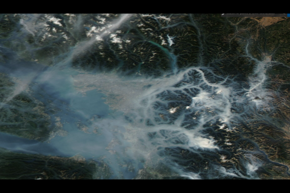
The images capture the cause of the city's smoky skies recently as fires in central Washington, east of Seattle, send plumes into the sky. The fires in the Wenatchee National Forest and surrounding areas are being blamed for the dim sky in Vancouver recently, as winds and valleys guide smoke to the coast.
In the photos, valleys filled with dense smoke can be clearly seen which then drift down toward the ocean. In some cases, the smoke is guided into the Fraser Valley as well, where it slowly makes its way to the ocean.
The smoke has left Vancouver with some of the worst air in the world. On Oct. 17 it was estimated breathing Vancouver's air for a day was akin to smoking five cigarettes.
As of 1:30 p.m. on Oct. 18, Vancouver's air was ranked second-worst of any major city in the world (160 on the US Air Quality Index). Portland, Oregon, which is also dealing with wildfire smoke and sits in a river valley, tied Vancouver (160). Seattle isn't far behind at 10th (143). Vancouver is currently at 15 times the PM2.5 concentration (particulate matter measuring 2.5 micrometers or smaller) recommended by the World Health Organization.
When will clear skies return?
An Environment Canada meteorologist says clear skies will hopefully return Wednesday morning.
As a system pushes in from the Pacific Ocean, the air should clear. The clear skies will be a precursor to the rain that will follow as part of the system coming in from the Pacific. On Friday, Oct. 21 it's expected Vancouver's drought will end as well, as rain is predicted.


