A hiker stranded on a cliff on the backside of Mount Fromme had to be rescued over the weekend after being led astray by a faulty map.
North Shore Rescue had their services requested by the RCMP after a man called 911 around 3:15 p.m. Saturday, Nov. 4. He was lost and stranded after following a trail recommended by Google Maps that didn’t exist.
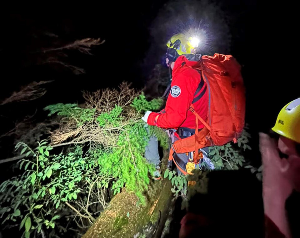
The man was uninjured, said search manager Dave Barnett, but was “a little shaken up, cold, and scratched from hanging on and sliding in the steep terrain.”
The hiker had been “extremely lucky” to get his coordinates across to rescue teams moments before his mobile phone died, said Barnett, ensuring they could hone in on his location: a “very steep and treacherous” area of the mountain.
With cloudy weather preventing the Talon Helicopter’s hoist aircraft from making its way higher up the ridge, the team was forced to place two rescue technicians below the stranded hiker, said Barnett.
They traversed up steep terrain using ropes before harnessing the man and belaying him back down to where they had entered, before waiting 30 minutes for a break in the clouds so the circling Talon could carry them to safety, he said.
“We were able to get all three out thanks to the skill of the talented helicopter pilot."
Barnett said the incident should serve as a warning for hikers to be wary of being misdirected by misinformation online, and to instead follow a “proper, topographical map” that shows elevation and contours.
“Do not follow street maps, or any other urban city mapping application for navigation in the wilderness. In this area in particular there were errors on Google Maps that showed what looked to be a trail, but resulted in this hiker going off into steep terrain,” he said.
North Shore Rescue have put up warning signs in the area and Google has since removed the incorrect trail from its map, following a request from the search and rescue team, said Barnett.
This isn’t the first time rescue teams have had to come to the aid of misdirected hikers in this area.
Just two weeks ago a man veered off trail from his planned route to Norvan Falls, resulting in an hour-long stranding on a treacherous cliff face and an emergency rescue by the local services. In 2021, a hiker died in the area after also veering off from the safety of the official trail.
Both incidents were within a few 100 meters of the same location teams were sent Saturday, said Barnett.
“This is a very dangerous area that people should be staying out of.”
Mina Kerr-Lazenby is the North Shore News’ Indigenous and civic affairs reporter. This reporting beat is made possible by the Local Journalism Initiative.


