On Monday morning, Nov. 15, Henry Robinson looked out the window of his motel room at the Double D Inn in Merritt. About 30 metres away and closing fast, the shores of the Coldwater River were climbing toward him.
"Holy Jesus!" he remembers saying to himself. "That's a lot of river running down."
An hour later, he heard a knock at the door. Outside, the manager was frantic. Just after 10 a.m., the city had issued a blanket evacuation order for its roughly 7,000 residents. Soon, the city would be engulfed in water.
"It was just grab what you can. I grabbed my essentials, my wife's pills, jumped in the car and drove off," said Robinson.
Across town, Dylan Bullock and his girlfriend Maria Cihlar had just moved into their new home when they woke up to half a metre of water in their bedroom. Bullock, a wildland firefighter who suffered burns to his chest, neck, arm and face while fighting the massive Sparks Lake wildfire northwest of Kamloops in July, grabbed his wet and frightened cat and fled town.
Both couples are among roughly 50,000 British Columbians displaced by wildfire and flooding this year. But unlike many, who have faced a single devastating event, Bullock and the Robinsons have faced a series of cascading disasters.
In June, wildfire primed by a record heatwave drove the Robinsons, both 82, from their Lytton home and cherished fruit orchards. Bouncing from motel to motel, they eventually landed in Merritt, only to be evicted again by rising floodwaters.
"We had the fire; we had the flood. What's coming after Christmas? Tornados? An earthquake?" he told Glacier Media from the Scott's Inn in Kamloops. "It's been a terrible year. We don't know if we have many left."
As the Robinsons once again find themselves in limbo, waiting to pick up the pieces of their life, there's emerging evidence that it's not just the experience of a growing number of climate refugees that link summer fire with winter floods.
Fire scars, say experts, may be responsible for at least some of last week's flooding and landslides.
"It's not rare at all, these sort of very quick, fast-moving events that can happen three to five years after a fire," said François-Nicolas Robinne, wildfire risk scientist with the Canadian Forest Service.
Robinne is one of a handful of scientists who have set out to hunt down that link wherever it leads. But with few resources and limited data, pinning a flash flood or mudslide to an old fire scar is a massive challenge.
"We need more people to better understand what happened, where and why," he said.
HOW DOES FIRE LEAD TO FLOODING AND LANDSLIDES?
Think of an intact forest as a giant sponge, said Lori Daniels, a professor in UBC's forestry department, researching forest dynamics and adaptation to climate change.
When rain falls on the tree canopy, it gets caught in the leaves and needles, slowly dripping to the ground where it's soaked up by decomposing leaf litter and dead logs.
From there, the rainwater percolates into the soil, eventually becoming groundwater. That slow drip acts to flatten peak flooding during extreme rainfall events in the same way social distancing can flatten the curve of COVID-19 cases.
But when a wildfire burns through a forest, the sponge effect is annihilated, said Daniels.
Without a tree canopy and a spongy surface layer of organic debris, the full force of the rain slams into the soil. But it's a process invisible to the eye that can have the biggest knock-on effects for flooding: the same aromatic oils that give a forest its pungent smell drip into the soil when they are burned out of needles and leaves. Once the fire stops and everything cools, these oils create a coating below the ash and soil, like wax paper, said Daniels.
"Think now about dropping water on wax paper. It doesn't go into the wax paper. It beads on top," she said.
With nowhere to go, rainwater pools. First, into puddles. It eventually tips downhill and turns into flash floods and torrents, toward the lowest point in the landscape, which are often communities at a valley bottom.
It's not clear how much of the recent floods and landslides can be attributed to this waxy layer, but that hasn't stopped some scientists from hunting down the answer.
For Jeremy Venditti, that search began with an overwhelming concern for salmon. On Nov. 19, four days after the atmospheric river hit B.C., he jumped on a helicopter and flew up the Fraser Canyon near Lytton on a reconnaissance mission.
An SFU professor of environmental science and geography, Venditti has spent years tracking the effects of landslides on salmon populations up and down the Fraser. But while the fish appeared to have been spared during the storm, the town and surrounding Indigenous communities had been cut off at multiple choke points.
Venditti counted 15 serious landslides in the area. At Tank Hill, where a massive debris flow wiped out the highway and rail line, he said it was clear the 2021 wildfires created the perfect conditions for failure.
"It is one of the worst-hit sites," he told Glacier Media. "There's a clear connection between the fire and the washout of the road."
SATELLITE IMAGERY SHOWS FIRE-FLOOD OVERLAP
Often described as mudslides, debris flows form when a slurry of mud, tree trunks and boulders up to the size of a garage tear down a gully at up to 36 kilometres per hour, decimating nearly anything in its path.
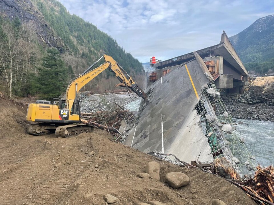
Last week in B.C., the phenomenon trapped 275 people overnight on Highway 7 near Agassiz, killed at least four people on Highway 99 north of Pemberton, and reportedly knocked out the Coquihalla Highway, downhill from burn scars left this summer by the July Mountain Fire outside of Merritt.
Robinne, who doesn't have access to a helicopter, has turned to satellites. Together with UBC Okanagan professor Mathieu Bourbonnais, the researchers have identified at least two watersheds around Lytton where flooding and debris flow appear to overlap with wildfire scars.
Upstream of the devastated City of Merritt, they have also been examining serious fire scars in three watersheds, including the Coldwater River, which flows through town and past the now-evacuated Doubly D Inn.
Robinne's analysis, still in its early stages, indicates that wildfires around 15 kilometres upriver from Merritt may have worsened the floods. But a huge amount of uncertainty remains, he said.
Robinne said their best chance is to plug satellite imagery, watershed maps and burn perimeter data into a computer model to get some conclusive answer. The modelling can then simulate last week's rainfall with and without wildfire and see if mudslides and flash flooding still appear.
What's missing, said Robinne, is comprehensive field data, such as soil samples taken after a fire but before rainfall washes away the waxy layer.
"The U.S. is much more advanced in this kind of situation," he said. "They send a team over there, and the team is right there after the fire — sometimes it's still burning."
"We absolutely don't have that here."
IS IT TIME FOR B.C. TO ADOPT A U.S.-STYLE FLOOD WARNING SYSTEM?
As B.C. lurches into recovery, several experts interviewed for this story say it's time for the province to consider rolling out an early warning system to notify residents of impending flash floods and mudslides.
Last week, Environment Canada scientists revealed to Glacier Media they are accelerating the launch of an atmospheric river rating system similar to the warnings broadcast ahead of a hurricane or tornado.
But forecasts are most effective at a local scale, and understanding how major weather systems can trigger deadly mudslides or flash flooding requires detailed analysis on the ground.
In the American West, where a multi-year drought has driven a cycle of mega-fires and flash flooding, scientific rapid response teams form a linchpin in the U.S. government's ability to warn residents of impending disaster.
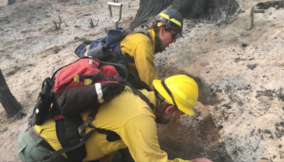
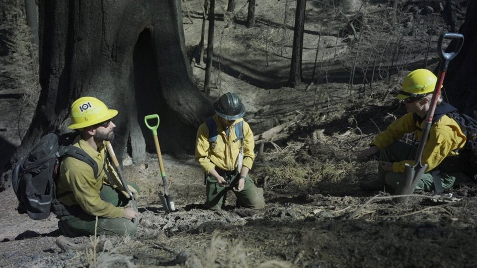
Once a wildfire has been contained on federal land, the Burned Area Emergency Response teams (BAER) are immediately deployed to collect data on increased threats from post-fire flooding, debris flows and rock slides.
The teams are made up of several specialists, including hydrologists, engineers, biologists and even archaeologists. Together, they decide what kind of emergency stabilization should be rolled out to protect life, property and cultural assets.
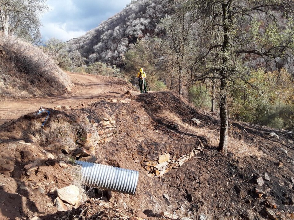
That could mean reseeding the ground with fast-growing native species or mulching hill slopes with straw and wood chips. In some cases, they will install a debris trap, modify a culvert under a road, or construct an emergency spillway to protect bridges and roads from getting washed away.
They pull satellite images to see how much vegetation has burned in a fire and assign a burn severity index to the hillside in question: high, moderate or low. The satellite and field measurements are then sent back to people like Francis Rengers, a research geologist with the US Geological Survey's flood hazard program. Rengers and his team run the results through an equation developed through thousands of observations.
"We might say, 'OK, based on what you've given us, a rainfall intensity of 22 millimetres an hour has a 50 per cent probability [of triggering disaster]," he said.
First piloted in eight Southern California counties in 2005, the risk assessment has been passed on to the U.S. national weather service since at least 2016, which uses it to develop local flash flood and debris flow warnings.
Rengers, who is based in Golden, Colo., points to Glenwood Canyon as an example of how the early warning system has saved lives. Part of the Colorado River, the canyon acts as a choke point for I-70, a key highway corridor funnelling goods and people across the state.
In both 2020, the Grizzly Creek fire tore through Glenwood Canyon, burning 130 square kilometres of the hillside, much of it next to the highway. When heavy thunderstorms arrived in late July this year, Rengers and his team passed along warnings at seven points where their model said debris flows would bury the highway. After authorities closed the roads, all of their predictions came through.
"We had a close call. There was a night where the road was closed, and it looked like the weather had stopped, so they opened it back up. People were driving down, and then it started raining again," he said.
One woman escaped her car just before it was buried under a pile of mud. In the end, more than 100 people spent the night in a tunnel to escape danger.
"[Shutting the highway] was really inconvenient. It was painful. People really, really, really hated it because some people live and work at either ends of the canyon," he said. "But I think we can say that because we shut the road, we were able to save lives."
WHAT ARE THE LIMITATIONS OF ADOPTING A RAPID RESPONSE TEAM?
Adapting the BAER rapid response teams to B.C. fires could pose some challenges.
Finding enough experts and funding such a program is just the start. Rengers said the U.S. early warning system requires rain gauges within four kilometres of a mudslide to attribute it to wildfire correctly. That would require ramping up the number of temporary rain gauges in a number of watersheds — though that is something already done in many U.S. states.
A bigger challenge is the sheer scope of the task, especially as flooding and debris flows are made worse even outside extreme rainfall. Rengers said 77 per cent of recent debris flows made worse by wildfire in the southwest U.S. were triggered by rainstorms that had a recurrence interval of only two years. In other words, it doesn't take a massive storm to cause widespread damage to life and infrastructure.
At the same time, wildfire doesn't come close to accounting for all the flash floods and debris flows in B.C. Bourbonnais said forest harvesting also likely had a substantial effect on the recent flooding and mudslides.
"Monitoring and research in this area have been sorely lacking in B.C.," he told Glacier Media.
Yet deploying the rapid response teams to wildfires alongside important highways and the most threatened communities could still go a long way to saving lives.
Massive cement deflection berms have been built to protect lives and infrastructure in creeks notorious for such blowouts, such as Charles Creek on the Sea-to-Sky Highway. But that's an expensive solution.
For Vancouver-based geoscientist Matthias Jakob, the scale of flood damage expected to hit B.C. in the coming decades will likely be so big the best we can do is triage the damage.
"They require years of planning and construction, and they cost millions of dollars per structure," said Jakob. "We have thousands of streams in British Columbia with development on it. If you include the roads, railways, the pipelines, power lines, it's probably in the tens of thousands of streams. We don't have the money to build those structures, but what we can do is provide warning systems."
The problem with climate change, he said, is that we haven't asked ourselves if we are reaching the limits of what our current infrastructure can bear. The atmospheric river led to about 200 highway closures across the province, said Transportation and Infrastructure Minister Rob Fleming Tuesday.
"We've reached a climate, which is not analogous to anything that we've seen in the Holocene era, perhaps even in the last three million years," said Jakob. "We have to wrap our head around what is actually still manageable and what isn't."
In central and northeastern B.C., above-average precipitation will lead to such a high risk of landslides that some roads may simply have to close because they'll be too expensive to maintain, say the geoscientists.
"And then we have to ask ourselves — if a lot of these roads are not to be mitigated, or parts of towns like Quesnel, William Lake and Prince George — human retreat is really the only possibility," Jakob said.
"It's all over the place that we have these extreme events creating havoc, so we need to retrain our mind."
Stefan Labbé is a solutions journalist. That means he covers how people are responding to problems linked to climate change — from housing to energy and everything in between. Have a story idea? Get in touch. Email [email protected].


