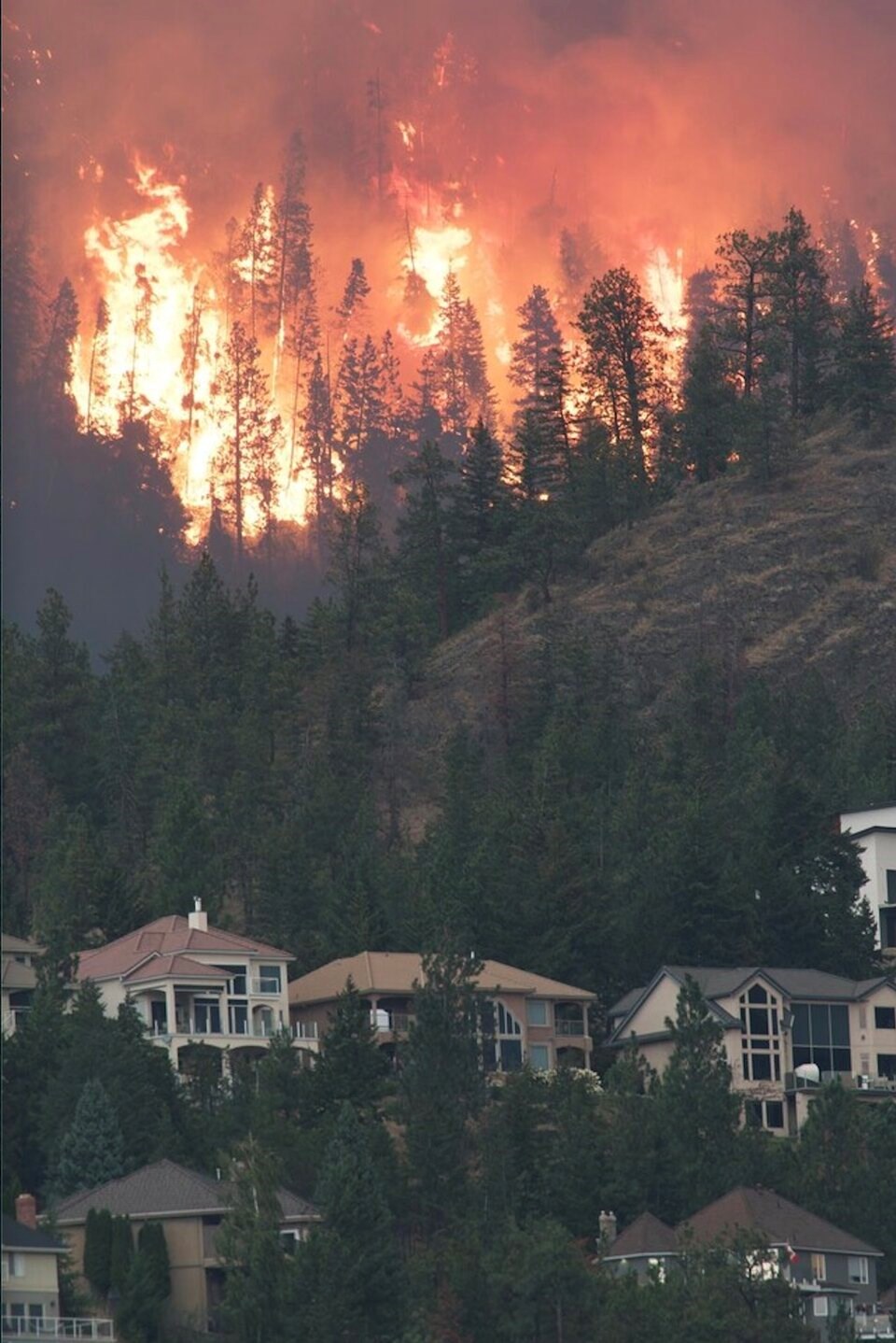
The extent of devastation caused by the McDougall Creek wildfire burning around the city of Kelowna, B.C., should be known later this morning after an all-night battle for fire crews.
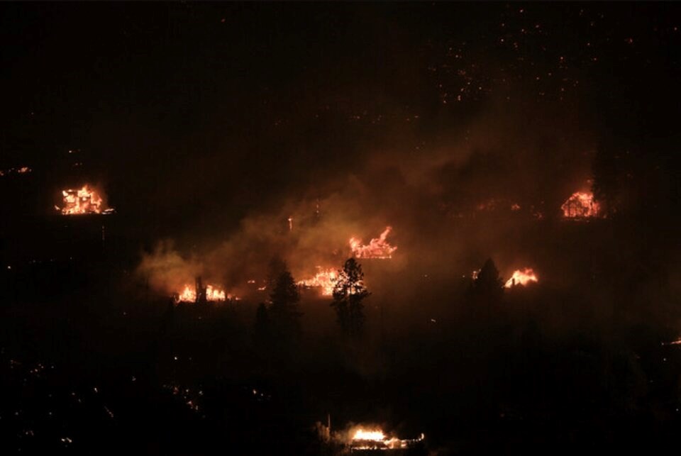
Emergency officials confirmed overnight that structures had been lost in both West Kelowna and the regional district, hours after images and photos started circulating of homes going up in flames in the Westside Road area.
By morning, 2,462 properties remained under evacuation order with 4,801 properties under evacuation alert. An interactive map of evacuation zones is here.
Central Okanagan Emergency Operations said an assessment would take place in the morning and a detailed update would be live streamed at 10 a.m.
It is not known at this point if homes were damaged when another wildfire erupted in the north Clifton Road area sometime before 10 p.m. Thursday night, forcing an entire new wave of evacuations on the east side of Okanagan Lake.
In an interview with Castanet News shortly after midnight, Kelowna Fire Chief Travis Whiting said fire departments from across the Okanagan and beyond sent crews to help battle both fires. A truck from as far as Hope was spotted by a Castanet reporter.
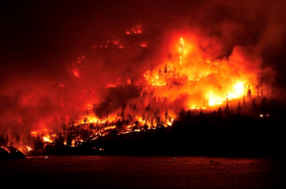
The BC Wildfire Service has now estimated the size of the McDougall Creek wildfire at 1,100 hectares.
The size, mapped out late Thursday night, is expected to increase once aircraft are able to get a better look at the fire this morning.
Whiting suggested the fire fight will stretch well into Friday and residents need to continue to stay aware of emergency alerts.
“They need to reach out to others in the community and offer help — help each other because a lot of people are being impacted here today,” he said.
“Definitely our hearts are with them. We're really hoping that the community helps each other out so that we can together get through the next couple of days.”
Emergency Support Service reception centres are expected to reopen in West Kelowna, Kelowna and Vernon this morning. Overnight, an evacuee shelter was set up at Kelowna’s Prospera Place for those who had nowhere to go overnight.
Westside Road is closed in both directions and access roads to Rose Valley are also closed off.
DriveBC has also issued a travel advisory for Highway 97 between Glenrosa Road and the William R Bennett Bridge. While the highway remains open motorists are being advised to be prepared for short notice closures due to the fire.
Anyone who has been evacuated are urged to register either online or at one of the three reception centres set up in West Kelowna, Kelowna and Vernon.
The following have been set up as reception centres:
- Royal LePage Place, 2760 Cameron Road in West Kelowna
- Kal Tire Place, 3445 43rd Avenue in Vernon
- Salvation Army Church, 1480 Sutherland Ave in Kelowna
More to come...


