Detailed images of an underwater geological fault off British Columbia’s Central Coast show the region could produce powerful megathrust earthquakes and tsunamis.
Published last month in the journal Science Advances, the findings show the Pacific tectonic plate is starting to dive under the North American plate near Haida Gwaii at a rate of up to 2.5 centimetres per year — nearly as fast as human finger nails grow.
According to Kelin Wang, a research scientist at the Geological Survey of Canada and a professor at the University of Victoria, the study provides a snapshot of an early-stage subduction zone that could help planners create better tsunami models.
“Big picture, it’s very similar to the San Andreas fault in California,” said Wang, who co-authored the study. “The two largest earthquakes ever produced in Canada were on that boundary.”
Sitting on a semi-liquid layer of molten rock, tectonic plates fit together like a floating geological puzzle — each plate a platform for a patch of seafloor or continent.
Always moving, they often slide by each other, pull apart, or collide along fault lines. Tension between the plates can build for hundreds or thousands of years, until one day, a rapid slip sends seismic shudders through the Earth. That occurred at 8:01 p.m. on Aug. 21, 1949, when a 8.1-magnitude earthquake rocked B.C.'s Central Coast in the largest event ever recorded in Canada.
Shaking on Haida Gwaii was so severe on that chimneys tumbled and cows were knocked off their feet, according to Earthquakes Canada. About 200 kilometres away in Prince Rupert, windows shattered and buildings swayed. In Terrace, cars bounced around and standing in the street was “like being on the heaving deck of a ship at sea.”
Despite the quake's intensity, scientists knew little about the fault zone’s structure. Some predicted the two plates were sliding past one another, occasionally deforming and piling up rock as they went.
Others pointed to indirect evidence — including seismological readings, heat studies and ocean floor bathymetry — that suggested the heavier oceanic plate had indeed begun to slide under the lighter North American plate in a process known as subduction.
When a 7.8-magnitude earthquake struck the region again, this time in 2012, it triggered a tsunami and strongly suggested the fault involved subduction,
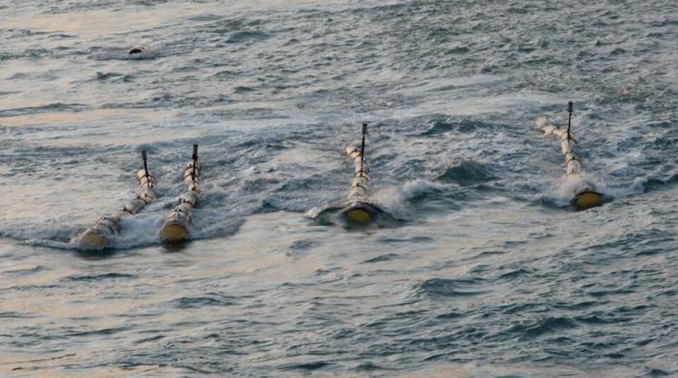
Still, scientific debate had not been settled. To solve the mystery, a dozen scientists from several U.S. and Canadian institutions deployed a 15-kilometre-long hydrophone streamer — essentially a long cable — off the back of a ship and 12 metres below the surface of the ocean.
Equipped with thousands of underwater microphones, the device used air guns to bounce sound waves off the ocean floor like a large-scale medical X-ray. When the sound came back, the scientists were able to create detailed sub-seafloor maps, that in some cases, penetrated 30 kilometres below the surface.
Co-author Michael Bostok, a University of British Columbia professor in the Department of Earth, Ocean and Atmospheric Sciences, said the latest results provide important confirmation of what many increasingly thought likely: the Queen Charlotte plate boundary is a megathrust fault.
“We can see one plate going under the other,” Bostok said. “It’s compelling direct evidence.”
“This really nails the story,” added Wang. “There’s no doubt that subduction is taking place.”
Wang said that by getting a snapshot of a “brand new” subduction zone just being formed, the mapping could also help scientists and authorities improve earthquake preparedness.
“We don’t really have a very rigorous tsunami model for the West Coast,” said Wang. “Part of the reason was the tectonics was not clear.”
“Now, we have a better tectonic model to guide us, to think about hazards.”
The researchers caution the region now runs the risk of getting hit with other large megathrust earthquakes where tsunamis are more common.
However, Bostok said the tension released by the 2012 earthquake makes another large subduction quake unlikely any time soon. At four centimetres per year, the Cascadia subduction zone off Vancouver Island is building up tension much faster, he added.
The young fault line off Haida Gwaii is still missing an area of increased small earthquakes and a volcanic arc — tell-tale signs of a mature subduction zone seen in Cascadia's Mount Garibaldi, Mount Baker or Mount Hood to the south, Bostok added.
“We’re looking at 10 to 20 million years to see volcanoes in Prince Rupert,” he said.


