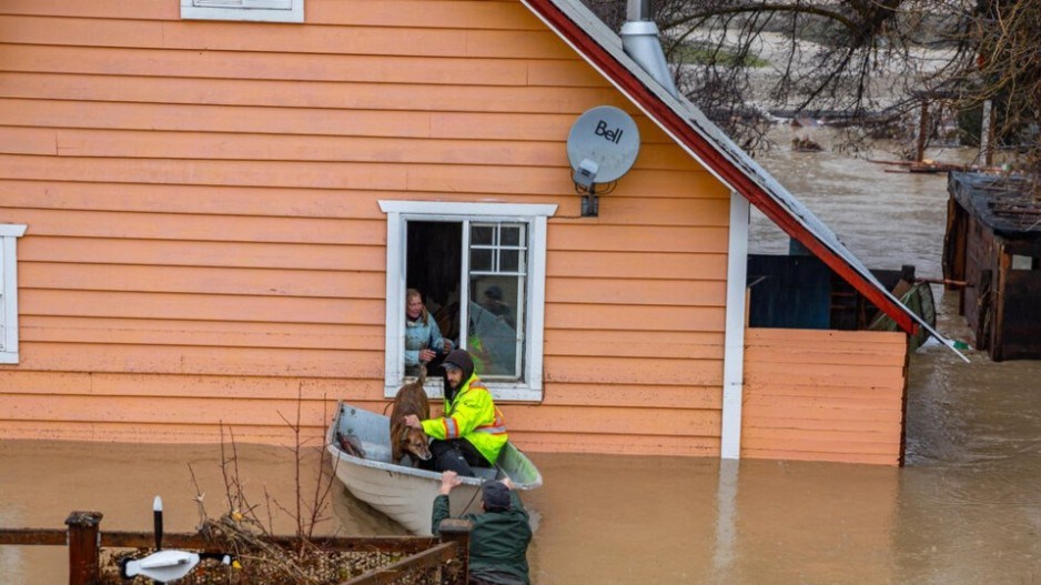
Floodplains and atmospheric rivers are increasingly top of mind for British Columbians, with many West Coast communities now building with the aim to mitigate against severe damage.
Squamish, Vernon and the Regional District of Kootenay Boundary have implemented initiatives to ensure new and existing construction projects aren’t at risk the next time floods sweep through the province.
There are approximately 1.5 million homes across Canada – about 10 per cent of the residential housing market – located in high-risk zones that are ineligible for flood insurance, according to an April 2023 report from the Intact Centre on Climate Adaptation.
Representatives from the three above-mentioned B.C. communities gathered for a panel at the Union of B.C. Municipalities convention on Sept. 20. Each shared unique lessons and challenges they have faced when trying to protect housing from floods.
District of Squamish: An integrated approach
For Squamish, building with flooding in mind means considering a combination of hazards.
Surrounded by mountains, the district is located at the head of the Howe Sound at the confluence of five major river systems. This means that most of the district’s development portion of the community is within a floodplain.
“Our downtown and in some of the surrounding areas, those are just a couple of metres above the mean sea level and so they're exposed to coastal hazards from a combination of high tides, storm surge and waves. And of course, those hazards are going to become worse over time with sea level rise,” David Roulston, manager of municipal infrastructure with the District of Squamish, said during Wednesday’s panel.
He said flood management in Squamish is “quite complex” because of the high rate of housing located on floodplains and as well as other hazards.
Squamish began updating its 1994 Flood Hazard Management Plan nine years ago, resulting in the Integrated Flood Hazard Management Plan (IFHMP) that provides new recommendations.
The official community plan informs the broad decisions on planning and land use management. This is used in conjunction with the district’s development permit area, which regulates development within floodways.
This comes in addition to a floodplain bylaw that regulates building elevations, setbacks from watercourses and dikes and other building regulations for new construction.
“It's a series of tools that we felt really was required to achieve all that we wanted to … We have controlled densification areas where there are restrictions on rezoning to increase the intensity of land use,” he said.
In the areas with the highest hazards, rezoning for increased land intensity is not supported by the district. For the areas with moderate to high risk, specific conditions need to be met for the district to support rezoning with density being limited to a duplex. In areas with moderate to low risk, another series of regulations must be met to support rezoning.
The flood hazard management plan cost the district more than half a million dollars and required significant amounts of staff time, according to Roulston.
“The lessons that we learned throughout the course of this are to use an integrated approach,” he said. “Think about what conditions development built today is going to experience by the end of its life, with respect to sea level rise or increased precipitation, and finally to resource appropriately.”
City of Vernon and Regional District of Kootenay Boundary
Floods swept through Vernon in 2017, 2018 and 2020.
The city developed a floodplain bylaw about a year ago that controls where a home can be built based on a flood construction level, which determines how to keep living and storage spaces above flood levels. Qualified professionals are required when building on floodplains.
Housing development is limited in areas with higher velocities of floods and deeper water, said Mark Dowhaniuk, manager of infrastructure with the City of Vernon and a speaker at the panel.
The bylaw includes exemptions such as renovations that will not add additional space to a residence or increases the elevation by no more than 25 per cent of the surface area.
Dowhaniuk highlighted that a challenge for the Okanagan is the number of qualified professionals in the region is not sufficient.
In the Kootenay Boundary region, local governments use a mix of bylaws, zoning, official community plans and restrictions to regulate how housing is built on floodplains.
The community spans more than 7,000 square kilometres and includes land in the Agricultural Land Reserve.
“It's a big region, we've got a lot of area to deal with,” Kristina Anderson, watershed planner with the Regional District of Kootenay Boundary, said during the panel. “We're really trying to encourage [building] outside of the floodplain. As a regional district, we don't have that capability of some of the municipality situations.”
A unique hazard is high erosion that can restrict construction even if a site is not located in an area with flood restrictions.
“Floodplain bylaws are definitely going to be our main tool to be able to decide where the present building sites are and really keeping people out of that setback area,” she said, referring to areas of potential erosion that are established to protect developments.

