For many, the existence of controlled burns is often a pinpoint on a provincial map or the occasional whiff of smoke.
But recently, Squamish mountain bikers had a chance to see one of these fires up close.
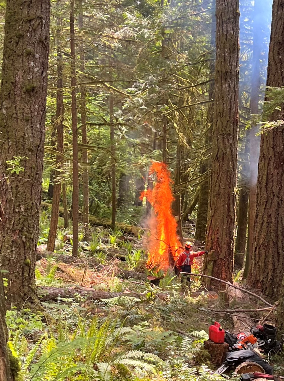
Riders who were cycling through the Legacy Trail found provincial personnel setting debris ablaze.
They said it was a fascinating site.
“The flame was very large and upon looking at the image, it looks like a forest service worker watching a fire godzilla,” wrote Zamon Kingi, who sent the picture to The Squamish Chief on June 1.
It’s part of a larger effort from the Sea to Sky Natural Resource District staff and BC Wildfire Service to address the ongoing threat of forest fires to the Squamish community.
They are currently burning piles of forest debris in seven locations near the town — so if you see smoke in these areas, don’t be alarmed.
Crews have been working on this project since 2020, and they’ve now reached the final stage. Having gathered forest debris into piles in seven locations east of Quest University, they are now moving ahead with burning them. Ultimately, this means there will be less fuel available for fires that do occur, making them harder and slower to spread.
The work is being carried out along Mamquam Road and Garibaldi Park Road, to the southern border of the Ring Creek residential area. The burning will be completed in stages, with the materials being gathered into mounds no taller than two metres and no wider than three metres. Burning will be intermittent based on multiple factors, including site accessibility, crew availability, weather, and venting conditions.
The piles will be ignited only if conditions are favourable. To reduce the impact of smoke on nearby residents, all burning will adhere to the Ministry of Environment and Climate Change Strategy’s Open Burning Smoke Control Regulation.
Removing accumulations of forest fuels will:
• help reduce the severity and spread of any future wildfires in the area
• help prevent a wildfire spreading into the tops of trees
• reduce wildfire threats to the community
• give firefighting crews better access to any future wildfire in this area
• provide a safer public evacuation route, if needed
This fuel management project started in the fall of 2020 and focuses on areas identified as facing a high wildfire risk. Work that’s already been completed includes understory thinning (removal of smaller trees and other vegetation through mechanical and manual falling), tree pruning, removal of surface fuels, and/or removal of other wood fibre. Older, mature trees were retained to provide shade and inhibit the regrowth of understory vegetation.
All personnel working on this project are following provincial COVID-19 public health orders and guidelines to ensure that operations can continue safely.


