Stand down, daffodil counters.
We may be on the verge of officially leaping into spring next week, but cooler temperatures are not quite done with us.
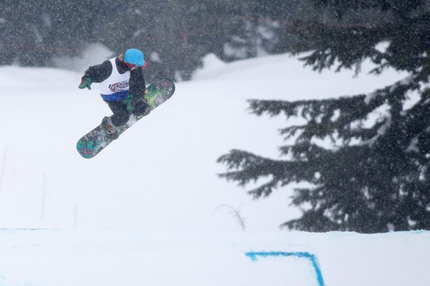
Gardeners will have to wait it out while skiers are in for a bonus as spring will take a while to warm up, say meteorologists.
“You’ll have no problem skiing well into the spring season,” said Michael Carter, meteorologist for the Weather Network. “We do look for silver linings.”
Snow could even fall again at upper elevations before the month is out, as the freezing level drops with cold fronts on Wednesday night and again on Sunday, said Matt MacDonald, meteorologist with Environment Canada. The good news is “it’ll be melting snow at the worst,” he added. The chance of significant snow accumulations – other than on the mountaintops – is done with, he said.
That’s likely a relief to West Coasters who prefer to break the shorts out sometime around April.
“There’s a lot of winter fatigue,” said Carter.
The beginning of March – which marks “meteorological spring” for forecasters – has been between four and five degrees cooler than usual, said MacDonald. In a normal spring, daytime highs are around 10 degrees with overnight lows of around 3. “Last week we were struggling to get up to six degrees,” he said.
That’s after three months of winter where average temperatures were two degrees colder than usual – making it Metro Vancouver’s 10th coldest winter on record.
Snowfall wasn’t record-breaking but a series of Arctic fronts meant “it stayed cool after the snow fell,” said MacDonald. “Our ground was white for a good majority of the winter.”
This winter was marked by six Arctic outbreaks in the Lower Mainland. “We typically only see one or two,” said MacDonald.
The extended winter has been good for North Shore ski hills.
Mount Seymour enjoyed a record-breaking number of skiers and snowboarders. More than 1,200 centimetres of snow fell on the ski hill over the winter, leaving 462 cm at the summit and 336 cm at the base this week, said Sandra Kadel, communications co-ordinator for the North Vancouver ski hill.
Cypress and Grouse ski resorts have celebrated similar bumper seasons.
Much of this year’s cold winter was brought to the West Coast courtesy of La Nina, a weather pattern that usually brings cooler-than-normal temperatures over winter months.
By mid-April, however, that cold weather pattern will loosen its grip, said both meteorologists, who predicted a return to normal spring temperatures in the second half of April and into May.
Long-range patterns – though still very unpredictable – are even currently hinting at a return to El Nino for next winter.
That won’t affect summer weather in the Lower Mainland, said MacDonald. That is mainly influenced by high pressure systems from California moving north, he said.
Come fall, however, the possibility of another El Nino – brought on by warmer than normal ocean temperatures in the equatorial Pacific – is “something we’re going to watch with great interest,” said Carter.

